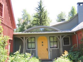
Scalzi's Monday Photo Shoot: Show me something interesting on the porch or patio of your house or apartment. For those of you with neither, fire escapes and window sills will suffice. If you want to play, click on the link, above.
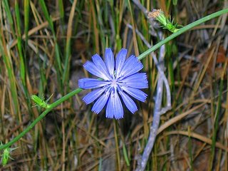
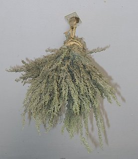
OK, here's mine: desert sage (Artemisia tridentata) that I gathered in Colorado. I've bound it up in a bundle and I'm currently drying it, suspended upside down on my patio, out of sunlight, so I can make sachets of the wonderful scent this fall.
And in case you’d like to try this...here are two simple recipes for sage sachets. Enjoy!
The first is for a sachet base that can be used to make lots of different scents. This base is a fixative, and you can use whatever herbs and essential oils you like. Mix the base with herbs in a ratio of 3 T base to 2 cups of herb (e.g., sage).
Fixative Base: Sachet or Potpourri
4 oz orris root powder
4 oz sandalwood powder
1 oz cedar powder
1 oz lavender flowers
2 oz rose petals
2 oz patchouli leaves
1 oz vetiver powder (vetiveria zizanioides)
1 oz benzoin powder
1 tsp clove powder
Simple Sage Sachet
Take some sage, either dried or fresh. Pack the leaves into a small muslin bag and add fresh orange peel. Drop it into a hot bath, step in, and enjoy.
Monday, July 31, 2006
Friday, July 28, 2006
Road Trip, ctd. - Day 6
Monday, July 16, 2006 - Day 6
Telluride to 4 corners to Monument Valley to Mesa - 505 miles
On Sunday night, after dinner, we sat in a hottub beneath a zillion stars in the clear, cool, Colorado night sky. It doesn’t get much better than that.
Monday morning, after breakfast and a brief tour of incredibly beautiful Telluride, including a gondola ride, we were off again, to the 4 corners and Monument Valley and Moab, Utah, before heading back to Mesa.
There’s just one place in the United States where 4 states come together at one point, and that place, located on Navajo Nation land, is called The 4 Corners Monument, or just "the 4 corners" for short. A and I took our firstborn, Alexandra, there when she was a baby, in 1977, and sat her tiny, diaper-clad bottom on all 4 states: Arizona, New Mexico, Colorado & Utah.
For what it’s worth, the site, established by the US government in 1868, was a site of intersection in the 17th century, too, although the 4 groups represented at that time were not states but peoples: the Spanish, Apaches, Utes and Navajos of the region.
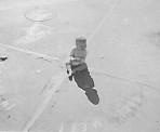
It was Arizon hot in that part of the country, and when we skirted through Arizona and stopped, so I could take a pic of my shadow, the heat was formidable.
From the 4 corners, we drove Hwy 160 west and south, to Kayenta, NM, and on to Monument Valley. If you haven’t been to Monument Valley, you need to go, preferably at sunset, when the shadows loom long, making the red buttes even redder.
Monument Valley is stunning, and it's easy to see why it's been the setting for more Westerns than any other site in the US. Happily, it still looks almost exactly as it did in 1938, when John Wayne and John Ford went there to film Stagecoach.
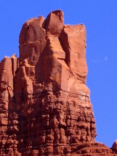
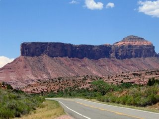
From Monument Valley, we drove on Hwys 163 and 191 to Moab, Utah. On the way, I spotted this amazing rock:
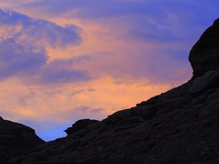
In Moab, we had a bad dinner but a decent beer (Polygamy Porter) at Eddie McStiff's. A & I were both disappointed that on this trip, there was no time to spend exploring either Arches or Canyonlands National Parks. Nevertheless, as we drove out of Moab, on Hwy 128, we saw a spectacular sunset above the canyon walls before driving back to Mesa.
Monday, July 24, 2006
Road Trip, ctd. - Day 5
Sunday, July 15, 2006
Mesa to Telluride via Unaweep/Tabeguache Scenic and Historic Byway 180 miles
On Sunday, we drove 180 miles from Mesa to Telluride via Hwys 141 & 145, the Unaweep/Tabeguache Scenic and Historic Byway. This is not the fastest way to get to Telluride, but it proved to be an incredibly beautiful drive, beginning with 43-mile long Unaweep Canyon, which runs northeast-southwest and cuts through the Uncompahgre Plateau, and going on south, through the Dolores and San Miguel River valleys. Unaweep is a Ute Indian word meaning Canyon with Two Mouths. The Utes named it that because Unaweep is the only canyon in the world that has a divide in the middle (Unaweep Divide), with streams running out of both ends: East Creek, which drains east, to the Gunnison River, and West Creek, which drains west, to the Dolores River.
From our starting point at Mesa we drove to Grand Junction, then took Hwy 50 to Whitewater, where we turned southwest, onto Hwy 141, the beginning of Unaweep Canyon. In the canyon, both sides of the road were flanked with spectacular, towering (up to 3000 feet above the road) grey (Dakota) and dark red (Wingate) sandstone and granite cliffs.
Approximately 22 miles into the canyon, we saw the ruins of the Driggs Mansion, in front of a geographic landmark, Thimble Rock. Despite its name, Driggs Mansion wasn’t a mansion at all, but a simple, 6-room, hunting lodge/house, that was built for a wealthy New York lawyer, author and editor, Laurence La Tourette Driggs, between 1914 and 1918. Mr. Driggs hired a local Italian stone mason, Nunzio Grasso, to construct the 6-room hunting lodge/house on 320 acres of land, using water from West Creek. Sandstone cut from nearby Mayflower Canyon was used for the walls of the place. According to local legend, the Driggses moved in after construction was completed in 1918, only to leave after just a few weeks. Colonel Driggs subsequently sold the property in 1923, after which the building was used as part of a ranching operation until the 1940's. The roof was removed in the 1940's, and many of the stones from the walls were carried away in the 1950's, leaving the ruins that are visible today. In September, 2005, Driggs Mansion was added to The Colorado State Register of Historic Properties.
Driggs Mansion, shortly after it was built, and Driggs ruins, current
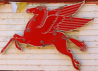
A few miles beyond the Driggs Mansion is the Unaweep Seep, aka "Swamp Hill”. This is a 55-acre area where natural springs, seeping through the rock, have created a marshy, riparian ecosystem (basically, a wet meadow) that is one of the few known habitats of a rare butterfly, Nokomis Fritillary. We didn’t stop there (and didn’t see any butterflies) but continued driving west along Hwy 141, through the remainder of Unaweep Canyon, to the town of Gateway. We stopped at Gateway so I could photograph this old Mobil Oil Pegasus at the gas station/motel/cafe/grocery store:
At Gateway, Hwy 141 meets the Dolores River (a tributary of the Colorado River) and turns south, following the river through the Dolores River Canyon. Approximately 40 miles down the road (marker 83.5), I spotted a dome-shaped coke oven on the west side of the road. Built in the 1880's, the oven was used to heat coal to produce coke, an almost smoke-free fuel. Coke from this oven may have been used by blacksmiths during the construction of the Hanging Flume.
Coke oven (not my pic)
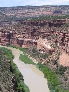
Dolores River Canyon with Hanging Flume ruins, highlighted
Flume ruins, highlighted
A couple of miles beyond the coke oven, we came to Hanging Flume Turnout. Merriam-Webster defines flume as an inclined channel for conveying water, and that is exactly what I was looking at, or at least, the remnants of that, still amazingly suspended over a hundred feet above the canyon floor, on the face of the dark red, Wingate Sandstone cliffs of the Dolores River Canyon. In the late 1880's, gold was being mined in the San Juan Mountains of Dolores Canyon by the Montrose Placer Mining Company, but hydraulic power was required to separate the gold ore from the rock. Although the Lone Tree Placer site was just 40 feet above the Dolores River, the technology to pump the water directly from the river to the site at the volume and pressure necessary to separate the gold ore from the rock had not yet been developed. Accordingly, the Montrose Placer Mining Company decided to construct the Hanging Flume, to provide the hydraulic power required to operate the mining equipment. Construction of the 4' deep, 5' wide, 13-mile long Flume was begun in 1888, and completed in 1891. During the brief period of its operation, the flume delivered over 23 million gallons of water each day from the San Miguel River to the Lone Tree Placer site. However, there wasn’t enough gold in the mine to cover the costs of the investment. The Montrose Placer Mining Company declared bankruptcy shortly after completion of the flume, which was then abandoned. The Flume is listed on the National Register of Historic Places.
We continued driving on 141, past the ghost town of Uravan, once a thriving mining town. Uravan was named by taking the first three letters of the uranium and vanadium (used in hardening steel) that were mined there from the 1930's through 1984 by the U.S. Vanadium Corporation, a subsidiary of Union Carbon & Carbide Corporation. Some of the uranium used to produce the first atomic bombs came from Uravan. A little beyond Uravan is another town with an unusual name: Nucla. Nucla was the home of the west’s first agricultural commune. According to Wikipedia, “Its name comes from the town's founders intent that it serve as a "nucleus" for the surrounding farms and mines, although it has since come to be associated with the growth of uranium mining in the region.”
In late afternoon, we drove into Telluride, which is located in a stunning box canyon.
We had a sandwich and a beer at the Brown Dog Café, and then walked around town a bit before going to A's friend's beautiful Victorian house, where we spent the night.
Mesa to Telluride via Unaweep/Tabeguache Scenic and Historic Byway 180 miles
On Sunday, we drove 180 miles from Mesa to Telluride via Hwys 141 & 145, the Unaweep/Tabeguache Scenic and Historic Byway. This is not the fastest way to get to Telluride, but it proved to be an incredibly beautiful drive, beginning with 43-mile long Unaweep Canyon, which runs northeast-southwest and cuts through the Uncompahgre Plateau, and going on south, through the Dolores and San Miguel River valleys. Unaweep is a Ute Indian word meaning Canyon with Two Mouths. The Utes named it that because Unaweep is the only canyon in the world that has a divide in the middle (Unaweep Divide), with streams running out of both ends: East Creek, which drains east, to the Gunnison River, and West Creek, which drains west, to the Dolores River.
From our starting point at Mesa we drove to Grand Junction, then took Hwy 50 to Whitewater, where we turned southwest, onto Hwy 141, the beginning of Unaweep Canyon. In the canyon, both sides of the road were flanked with spectacular, towering (up to 3000 feet above the road) grey (Dakota) and dark red (Wingate) sandstone and granite cliffs.
Approximately 22 miles into the canyon, we saw the ruins of the Driggs Mansion, in front of a geographic landmark, Thimble Rock. Despite its name, Driggs Mansion wasn’t a mansion at all, but a simple, 6-room, hunting lodge/house, that was built for a wealthy New York lawyer, author and editor, Laurence La Tourette Driggs, between 1914 and 1918. Mr. Driggs hired a local Italian stone mason, Nunzio Grasso, to construct the 6-room hunting lodge/house on 320 acres of land, using water from West Creek. Sandstone cut from nearby Mayflower Canyon was used for the walls of the place. According to local legend, the Driggses moved in after construction was completed in 1918, only to leave after just a few weeks. Colonel Driggs subsequently sold the property in 1923, after which the building was used as part of a ranching operation until the 1940's. The roof was removed in the 1940's, and many of the stones from the walls were carried away in the 1950's, leaving the ruins that are visible today. In September, 2005, Driggs Mansion was added to The Colorado State Register of Historic Properties.
Driggs Mansion, shortly after it was built, and Driggs ruins, current
A few miles beyond the Driggs Mansion is the Unaweep Seep, aka "Swamp Hill”. This is a 55-acre area where natural springs, seeping through the rock, have created a marshy, riparian ecosystem (basically, a wet meadow) that is one of the few known habitats of a rare butterfly, Nokomis Fritillary. We didn’t stop there (and didn’t see any butterflies) but continued driving west along Hwy 141, through the remainder of Unaweep Canyon, to the town of Gateway. We stopped at Gateway so I could photograph this old Mobil Oil Pegasus at the gas station/motel/cafe/grocery store:
At Gateway, Hwy 141 meets the Dolores River (a tributary of the Colorado River) and turns south, following the river through the Dolores River Canyon. Approximately 40 miles down the road (marker 83.5), I spotted a dome-shaped coke oven on the west side of the road. Built in the 1880's, the oven was used to heat coal to produce coke, an almost smoke-free fuel. Coke from this oven may have been used by blacksmiths during the construction of the Hanging Flume.
Coke oven (not my pic)
Dolores River Canyon with Hanging Flume ruins, highlighted
Flume ruins, highlighted
A couple of miles beyond the coke oven, we came to Hanging Flume Turnout. Merriam-Webster defines flume as an inclined channel for conveying water, and that is exactly what I was looking at, or at least, the remnants of that, still amazingly suspended over a hundred feet above the canyon floor, on the face of the dark red, Wingate Sandstone cliffs of the Dolores River Canyon. In the late 1880's, gold was being mined in the San Juan Mountains of Dolores Canyon by the Montrose Placer Mining Company, but hydraulic power was required to separate the gold ore from the rock. Although the Lone Tree Placer site was just 40 feet above the Dolores River, the technology to pump the water directly from the river to the site at the volume and pressure necessary to separate the gold ore from the rock had not yet been developed. Accordingly, the Montrose Placer Mining Company decided to construct the Hanging Flume, to provide the hydraulic power required to operate the mining equipment. Construction of the 4' deep, 5' wide, 13-mile long Flume was begun in 1888, and completed in 1891. During the brief period of its operation, the flume delivered over 23 million gallons of water each day from the San Miguel River to the Lone Tree Placer site. However, there wasn’t enough gold in the mine to cover the costs of the investment. The Montrose Placer Mining Company declared bankruptcy shortly after completion of the flume, which was then abandoned. The Flume is listed on the National Register of Historic Places.
We continued driving on 141, past the ghost town of Uravan, once a thriving mining town. Uravan was named by taking the first three letters of the uranium and vanadium (used in hardening steel) that were mined there from the 1930's through 1984 by the U.S. Vanadium Corporation, a subsidiary of Union Carbon & Carbide Corporation. Some of the uranium used to produce the first atomic bombs came from Uravan. A little beyond Uravan is another town with an unusual name: Nucla. Nucla was the home of the west’s first agricultural commune. According to Wikipedia, “Its name comes from the town's founders intent that it serve as a "nucleus" for the surrounding farms and mines, although it has since come to be associated with the growth of uranium mining in the region.”
In late afternoon, we drove into Telluride, which is located in a stunning box canyon.
We had a sandwich and a beer at the Brown Dog Café, and then walked around town a bit before going to A's friend's beautiful Victorian house, where we spent the night.
Saturday, July 22, 2006
Road Trip, ctd. - Day 4
Saturday, July 15, 2006
Day 4 Mesa to Glenwood Springs via Collbran & Rifle 168 miles
On Saturday we drove to Glenwood Springs via Collbran and Rifle (where Teddy Roosevelt went to hunt bears in 1901). We also made brief forays into Parachute and DeBeque. Parachute is a booming retirement community, but it held no particular charm for me, and DeBeque had no appeal whatsoever. We had lunch in Rifle, where I got a photo of a great sign:
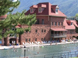
Glenwood Springs and the Hotel Colorado
The Ute Indians knew about the geothermal sulfur hot springs at Glenwood for centuries before the springs were “discovered”by a group of explorers led by Captain Richard Sopris (of Mt. Sopris fame) in 1860. To the Utes, the springs were a sacred healing place. The Utes called the springs “Yampa”, or Big Medicine.
Many famous people have visited the springs over the years, seeking cures for various ailments. Doc Holliday and Buffalo Billy Cody both visited the springs when they were terminally ill, too late to reap any benefits, and both died at Glenwood Springs; Doc Holliday in 1887; Buffalo Bill in 1917. Teddy Roosevelt was a frequent visitor to the springs and the Hotel Colorado (which was sometimes referred to as “the little White House”). The Unsinkable Molly Brown was also a frequent visitor. In WWII, the hotel was used as a U.S. Naval Convalescent Hospital, the only time in history that the pool was closed to the public.
I'm very fond of the springs myself. In the winter of 1991-92, my kids and I lived in Aspen. On Saturdays, the five of us used to pile into my Honda Accord, and I’d drive down to Glenwood, where we all enjoyed sitting in the 90 degree water and looking up at the snow-covered mountains all around us.
Road Trip, ctd. - Day 3
Friday, July 14, 2006
Day 3 - Mesa
We spent Friday exploring Mesa and the surrounding area. A borrowed Nathalie’s truck (a Dodge 4X4 hemi), and with Louis and I accompanying him, he drove up Land’s End Road to the Land’s End Observatory on the top of the Grand Mesa, “the world’s largest flat-topped mountain”, which was called Thunder Mountain by the Ute Indians who used to live there.
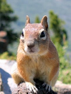
The view from the top, 11,000 feet above sea level in some places, is amazing. On a clear day, you can reportedly see from Utah to central Colorado without turning your head. Despite the drought, the top of the mesa was lush, and covered with Pinon, juniper, Engelmann spruce, cedar, and aspens. A drove the truck down a long, difficult dirt road, but it was worth every jolt of the rough ride, because we saw alpine lakes, and meadows of wildflowers, including Indian paintbrush, lupine, columbine, penstemon, blue aster, fireweed, larkspur, cinquefoil, and candytuft...to name a few. We also saw lots of chipmunks and a blue grouse.
Days 1 & 2
Day 1 - Wednesday, July 12, 2006
Dallas to Denver: 801.1 miles
A showed up at a little after 7:00, and we loaded my two bags and down pillow into his car. After stopping briefly at Starbuck’s for a little caffeine fortification to go, we drove out of Dallas on Hwy 114, eventually making our way to 287, which we took to Amarillo, in the Texas panhandle. From Amarillo, we took 87 and 64 to Raton, NM, then 25 North, all the way into Denver. We arrived at Brad & Susan’s house in Aurora at a little after 8:00 PM, Denver time. We’d made good time, managing to drive just over 800 miles in about 13 hours, including a brief stop for lunch. Brad provided some much appreciated gin and tonics, and Susan had prepared a delicious dinner of paella with brown rice, which we devoured as their daughter, Molly, told us about her latest adventure, being a Rocky Mountain Roller Girl (not to be confused with her day job).
Day 2 - Thursday, July 13, 2006
Denver to Mesa (via Leadville and Aspen): 280.2 miles
"Please do not shoot the pianist. He is doing his best."
After breakfast, we drove approximately 100 miles (via I-25, 6, 70 & 91), to Leadville, Colorado, the highest city in the United States (10,152 feet, or almost 2 miles above sea level). Leadville has fallen on hard times, but in 1880 it was the site of one of the world’s biggest silver camps, with a population of over 40,000. Many celebrities visited Leadville at that time, including Oscar Wilde, who claimed to have seen the words quoted above on a notice printed above the piano in a local saloon.
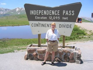
From Leadville, A drove almost 60 miles, up Highway 82, over Independence Pass (12,095 feet) and down into Aspen. Independence Pass was as narrow as I remembered, but incredibly lush and green.
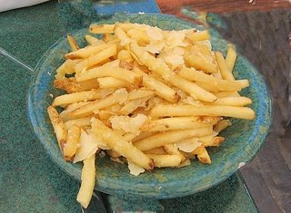
In Aspen, we had lunch on the deck of Ajax Tavern, at the base of Aspen Mountain (aka Ajax). We began with prosciutto wrapped figs stuffed with pecorino (delicious). A then had a steak salad, which he liked, but the smoked chicken salad that I ordered was only OK. We shared a side order of the restaurant's trademark parmesan/truffle fries (french fries topped with shaved parmesan and white truffle oil, very Aspen) which were fragrant and fabulous. We washed it all down with ice tea.
After lunch, we drove to the little miner's house that A's lawyer father had bought after winning a case in 1948. A subsequently sold the house, 50 years later, in 1998.
Like almost everything in Aspen, including the tourists, it's been remodeled to the point that it's almost unrecognizable.
By 4:00 we were on the road again, driving Highways 82 and 70 approximately 120 miles, from Aspen to Mesa, where we met Laurie, Louis, Nathalie and Laura at Nathalie's rustic cabin just outside Mesa.
Thursday, July 20, 2006
Roadtrip
Tuesday, July 11, 2006
Tubing on the Guadalupe
I grew up on the Mississippi. Well, that’s not entirely accurate. I grew up in southeastern Minnesota, in a college town, past which the Mississippi swiftly ran. Living so near it, I could spell "Mississippi" by the time I was 6. I remember my older brother, Dick, impatiently saying to me, "Jude, it’s so easy, just memorize this!
M...
I...
crooked letter,
crooked letter,
I:
crooked letter,
crooked letter,
I:
humpback,
humpback:
I".
We never referred to it as the Mississippi, though, and I didn’t know anyone who did. We always just called it The River, as in: "Don’t go down to The River!" or "They were out on The River" or "Do you want to go swimming at The Lake or The River?"
Even though we didn’t live on it, to me, The River was a big part of my life the entire time I was growing up. It was spanned by a long interstate bridge, linking Minnesota to Wisconsin. Each year, in the first days of spring, when most of the snow had melted and the first buds were bursting forth, my Dad would invite me to accompany him on a walk across the interstate, across The River. 6th of 7 kids, I loved the attention, the one-on-one-time aspect of it, and I can still remember how it felt, the way he gripped my hand with his own big, hard, calloused hand. He’d helped sandbag the levee during the Flood of ‘53, and when he’d had too much to drink, that was one of the stories he liked to tell. It sounded thrilling and almost heroic to me, and as a result, every April, the mind-numbing monotony of living in a small college town in Minnesota in the 1960's was broken by the exciting possibility that The River, swollen with runoff from melting snow and spring rains, might once again FLOOD. That happened only once during the time that I lived there. I was in high school then, and although we were excused from classes to help sandbag and/or distribute coffee and donuts to the workers, the reality of The River flooding was much more frightening, and not nearly so thrilling, as I’d imagined.
The River was cold and muddy, but each summer a part of it was roped off for swimming, and as a kid of 8 or 9, sometimes I’d get on my bike and pedal across the interstate by myself, to the beach house on Latch Island, where I’d change into my suit and go swim in The River. There were places that the current was so strong that even sitting in the shallows, near shore, if I lifted my feet off the sandy bottom just a little, I’d be pulled along by the current.
When I was 9, I became friends with a girl, Chris W., whose family owned a houseboat. Each summer for the next several years, I spent many weekends on The River with Chris and her family. Her father would pilot the houseboat to a sandbar, and as soon as it was anchored, as Chris’ parents settled onto deck chairs with gin and tonics in their hands, Chris and I would lower the dinghy into the water and paddle off into a slough, looking for adventure, the sun warm on our shoulders. Sometimes we’d spend the night on The River, an experience I always loved. When I left Minnesota, although I was entirely ready to move on to new experiences and new places, I knew that a part of me would always miss The River.
Eventually, I moved to Texas. I love the heat, and the huge blue sky, and the stark beauty of the desert southwest, and yet I feel landlocked, and although I’ve lived here for 23 years, until this past weekend, I’d never been tubing on the Guadalupe.
A couple of months ago, somewhere on the web, I found a list of things recommended to enjoy tubing on the Guadalupe. It was a short list, of mostly obvious items: hat, sunblock, water, sunblock, sunglasses, sunblock, and sunblock. The only thing that I might not have thought of was the recommendation to wear tennis shoes, river shoes, or sandals rather than flip flops "‘cause the river’ll suck ‘em offaya". Uh-huh. I searched my closet for my TIVA river shoes, from a week-long white water rafting trip I took on the Salmon river in Idaho a couple of years ago. As soon as I found them, I knew I was good to go.
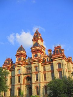
At a little after 2:00 on Friday afternoon, we left Dallas. There were 8 of us, and we drove down in two cars. On our way to Austin, we stopped at Lockhart, Texas, where we ate mouthwatering barbecue at Black’s, and took photos of the beautifully restored county courthouse before driving into Austin, where we spent Friday night in a cheap hotel, talking over each other, arguing, playing Cranium, and having a great time.
Saturday morning we woke to weather I can’t remember experiencing in July in the 23 years I’ve lived in Texas: rain and thunderstorms. We decided to drive to the river anyway. That was a good decision, because by the time we arrived at Canyon Lake to rent our tubes, the sun was shining and the day was Texas hot. At River Sports Tubes we signed up for a "medium", 4 hour float (as opposed to the short float of 2 hours or the long float of 7 hours). We rented 9 tubes: one for each of us and a "cooler tube" for our cooler, packed with an endless supply of water and a 6-pack of Shiner, so the 4 of us who are old enough to drink could have a ceremonial beer on the river. We put on gimme caps, t-shirts, and river shoes, slathered on sun block, picked up our tubes, and headed for the river.
The Guadalupe may be one of the most popular rivers in Texas, but it’s hardly the Mississippi. At approximately 250 miles long, it's roughly 1/10th the length of the Mississippi, and the section down which we were tubing was just a couple of miles long. Still, I was river-hungry and ready for a new adventure, so I stood eagerly on the banks of the Guadalupe, looking around me, at the place where we'd put in.
The water looked lazy and slow, and the moment I put a foot in, I discovered the spring-fed Guadalupe was surprisingly cool. It was also surprisingly crowded. There must have been at least a couple thousand people on the Guadalupe, from college students to other families to what Stephanie politely referred to as "country" people. In case you don’t know what that means...for the record, I saw more tattoos on Saturday than I’ve ever seen in my life, and probably more piercings, too, as well as some real river stupidity. Still, overall it was a mellow crowd, and I liked that.
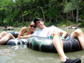
Stephanie & Chris, chillin' on the Guadalupe
The Guadalupe is at an all-time low, due to the drought, and much of the section we traveled was just a couple of feet deep. However, it was beautiful. There were two small "rapids", where flips flops might well have been lost had any of us worn them, but of course we hadn’t. Floating in tubes, our feet snug in our river shoes, we drifted down the Guadalupe, between limestone bluffs and tall cedar, pecan, cottonwood, oak, elm and sycamore trees . We saw baby ducks swimming, and a blue heron walking along the shore. The four of us who are old enough to drink opened the Shiners, and consumed those. Mike, Chris, Sara and Stephanie drank bottled water and gatorade. We got sunburned, and it felt good. There’s something about a river...
Wednesday, July 05, 2006
Saturday, July 01, 2006
The Walrus and The Carpenter
"The time has come," the Walrus said,
"To talk of many things:
Of shoes--and ships--and sealing-wax--
Of cabbages--and kings--
And why the sea is boiling hot--
And whether pigs have wings."
Tomorrow (July 2nd) I’m having a family party at my house to celebrate the 4th. When I say family, I really mean friends and family, because I consider my friends to be extended family. In addition to tomorrow’s party, we’ll celebrate the 4th again on the actual 4th, and we’ll go see fireworks on both the 3rd and 4th. In case you haven’t figured it out, I’m one of those women who believes that one can never have too many celebrations.
So today I cleaned the Weber, and tomorrow I’ll be grilling buffalo burgers. I’m a big fan of buffalo. It’s delicious, sort of like the best ground sirloin you’ve ever had, and yet even better than that. Some of those burgers will be plain, some will be topped with jalapenos and extra sharp cheddar, and some will be stuffed with blue cheese, according to whatever preferences are expressed. Tonight, I’m going to the symphony, but when I get home, I’ll make a dilled potato salad. For dessert, I’ll serve my traditional 4th of July cake (see pic, above). It’s made with with raspberries and blueberries, whipped cream, toasted slivered almonds, and Cointreau, among other things. I’ll also serve fresh cherries and a cannonball melon, and Anthony is bringing some of his delicious homemade sorbet (mango and raspberry). To wash it all down, I’ll serve iced beer and pomegranate mimosas, and pitchers of ice tea.
I’ve been thinking about my friends and family. There’ll be 10 of us here tomorrow, ranging in age from 3 to 67. Weather allowing, we’ll be swimming beforehand. I’m looking forward to this. We’re a lively, rowdy group. We like each other, but more than that, we enjoy each other’s company. We’re all interested in books and movies and politics, and none of us is shy about expressing our opinions. We all enjoy talking, so all of us tend to talk a lot, and truth be told, a lot of the time we talk over each other. If you were here with us, you’d here, "WAIT! No, you’re WRONG! Oh, you are SO wrong! Will you LISTEN to me?!?!?! Just the other day, I read..."
My kids’ friends always seemed to enjoy the lively atmosphere at our house, and could (and still can) often be found hanging out here. For example, tonight, even as I’m typing, there’s a group of 19 and 20-year-olds in my kitchen (one of whom is my son, Mike), talking, hanging out, eating take out and getting ready to watch a movie together. But sometimes people find this lively atmosphere daunting. I once dated a guy who said that coming to a family party at my house was like walking into the middle of a Woody Allen movie. I don’t think he meant it as a compliment, but I took it as a huge compliment. I like to think he was comparing me to Mia Farrow, in Hannah and Her Sisters, but I could be wrong...
And I once dated someone who used to wait, politely, trying to get a word in edgewise at these parties, only to never find an opening. At the end of the evening, I’d be in a great mood, filled with ideas and energy from all the lively conversations I’d had, only to find him pouting and morose. "What’s wrong?" I remember asking, solicitously, I thought. "Do you realize that all of you continuously interrupt each other?" he said. "Well of course we do! That’s how we talk. We’re excited and happy to see each other. You have to jump in! You can’t be shy! Just say, ‘hold it! I’m trying to say something!’ and all of us will shut up!"
He was wounded by my suggestion. Needless to say, the relationship didn’t last. Relationships come and go, but friends and family...that's what it's all about.
Happy 4th.
Subscribe to:
Posts (Atom)